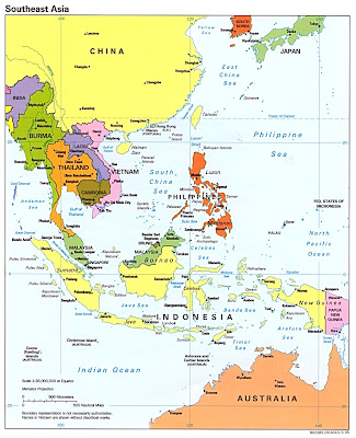
Time seems to be flying by these days. Christmas break is almost here and that means that Cambodia and Thailand are getting closer and closer. I'm way too excited to even think about it though. We've been planning this trip pretty much since I arrived and now it's so close. At home, I am always the one who plans each detail of every trip, but not here. While I might have been in on the idea of where to go, I owe it all to Aaron. This guy can plan a mean trip. He knows where to find the cheap tickets, best places to stay and even what to do while there. He has been to Cambodia before, but that did not stop him from going again. We've planned out the trip pretty well so far and I know I've mentioned it before, but I'm going to give you a detailed itinerary. I believe we leave Seoul around 2pm on Saturday, December 23. We fly to Hong Kong where we have a two hour lay-over.

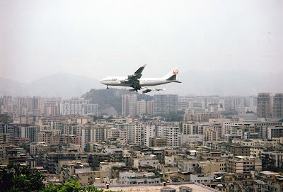
We won't be able to go into the city, but I've heard it's great. This picture does not look too hot though.
We leave the airport en route to Bangkok around 9pm and arrive in Bangkok at 11:50pm. Since we have an early train to catch there, we will just rock out that night and maybe sleep on the streets if we feel so inclined. I know Dave will, but that will be from drinking too much...like always. In fact, I'll tell you a great story later... We'll need to be at the Bangkok Hualamphong Train Station around 430am in order to catch the 500am train. The train costs 48 baht (around one dollar). That's right. Of course, it's all third class and the seats are wood, but that's all part of the experience. After a brief five hour ride through rural southeast Thailand we'll arrive at the border of Cambodia. The town is called Poipet.

Here's what wikitravel says about this rural Cambodian border town:
"Poipet is the gateway to Cambodia for many overland travellers coming from Thailand. It does not provide a very warm welcome. Gordon Sharpless notes that "Poipet more or less rhymes with toilet" and this caustic observation is, sadly, true. Poipet is a miserable huddle of touts, beggars, thieves and dodgy casinos for daytripping Thais, and spending any more time than absolutely necessary is not recommended. Other than gambling or whoring, there is no reason to stay in Poipet."
I thought this was classic...
Sounds fun, right? Well, I'm sure it will be an experience. After paying our 20 dollar visa fee we must split our group into two and get a cab driver to bring us down the dusty road to Siem Reap.

Aaron has informed that this is a very bumpy and rough road. Sleeping probably won't be an option. I know my eyes will be glued to the surrounding beauty.
The ride will take 3 and a half hours. It costs 45 dollars or so for the whole ride. That's not bad. Finally we'll be in Siem Reap. Here's a brief description of the city:
"Siem Reap, literally "Siam Defeated", commemorates a Khmer victory over the neighboring kingdom of Thailand. These days, however, the only rampaging hordes are the tourists heading to Angkor and this once quaint village has become the largest boomtown and construction site in Cambodia. It's quite laid-back and all in all a pleasant place to stay while touring the temples. It's a nice compromise between observing Cambodian life and enjoying the amenities of modern services and entertainment, thanks to the large expatriate community in Siem Reap. As business has increased, so have the numbers of people wanting your custom. Expect to receive almost constant offers for motodop and tuk-tuk rides, along with everything else which drivers may be able to offer to you. "
Once there we will go to our guesthouse and then start our trip out right...with a nice cold beer and a "happy" pizza. You can take a guess as to what a "happy pizza" might be. Here's a picture of it.

Then the next few days will be full of temples, jungles, elephant rides, floating villages, shady guides and plenty of beer and pizza. I don't want tot give the whole trip away before I even go, so I will not go into great detail.
The Tonlé Sap

The Tonlé Sap (meaning Large Fresh Water River but more commonly translated as Great Lake) is a combined lake and river system of huge importance to Cambodia. It is the largest freshwater lake in South East Asia and is an ecological hotspot that was designated as a UNESCO biosphere in 1997.
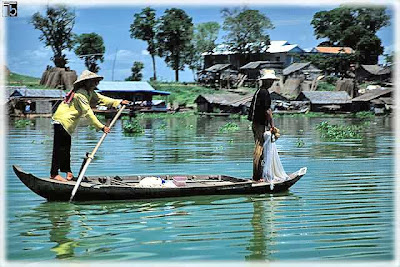
An old man rows a boat on the Tonle Sap Lake in Cambodia
For most of the year the lake is fairly small, around one meter deep and with an area of 2,700 square km. During the monsoon season, however, the Tonle Sap river which connects the lake with the Mekong river reverses its flow. Water is pushed up from the Mekong into the lake, increasing its area to 16,000 square km and its depth to up to nine meters, flooding nearby fields and forests. The floodplain provides a perfect breeding ground for fish.
The pulsing system with the large floodplain, rich biodiversity, and high annual sediment and nutrient fluxes from Mekong makes the Tonle Sap one of the most productive inland fisheries in the world, supporting over 3 million people and providing over 75% of Cambodia's annual inland fish catch and 60% of the Cambodians' protein intake. At the end of the rainy season, the flow reverses and the fish are carried downriver.
Among the national and local observers, and local people it is often stated that the Tonle Sap Lake is rapidly filling up with the sediment. However, recent long-term sedimentation studies show that net sedimentation within the Tonle Sap Lake proper has been in the range of 0.1-0.16 mm/year since ca. 5500 years before present (BP). Thus, there is no threat of the lake filling up with sediment. On the contrary, sediment is not a threat to the lake but an important part of its ecosystem, providing nutrients that drive the floodplain productivity.
The reversal of the Tonle Sap river's flow also acts as a safety valve to prevent flooding further downstream. During the dry season (December to April) the Tonle Sap Lake provides around 50% of the flow to the Mekong Delta in Vietnam.The lake occupies a depression created due to the geological stress induced by the collision of the Indian subcontinent with Asia.
ANGKOR THOM


The city lies on the right bank of the river Siem Reap, a tributary of Tonle Sap, about a quarter of a mile from the river. The south gate of Angkor Thom is 7.2 km north of Siem Reap, and 1.7 km north of the entrance to Angkor Wat. The walls, 8 m high and flanked by a moat, are each 3 km long, enclosing an area of 9 km². The walls are of laterite buttressed by earth, with a parapet on the top. There are gates at each of the cardinal points, from which roads lead to the Bayon at the centre of the city. As the Bayon itself has no wall or moat of its own, those of the city are interpreted by archaeologists as representing the mountains and oceans surrounding the Bayon's Mount Meru. (Glaize 81). Another gate — the Victory Gate — is 500 m north of the east gate; the Victory Way runs parallel to the east road to the Victory Square and the Royal Palace north of the Bayon.
A Gate leading to Angkor Thom
The faces on the 23 m towers at the city gates (which are later additions to the main structure) take after those of the Bayon, and pose the same problems of interpretation. They may represent the king himself, the bodhisattva Avalokiteshvara, guardians of the empire's cardinal points, or some combination of these. A causeway spans the moat in front of each tower: these have a row of devas on the left and asuras on the right, each row holding a naga in the attitude of a tug-of-war. This appears to be a reference to the myth, popular in Angkor, of the Churning of the Sea of Milk. The temple-mountain of the Bayon, or perhaps the gate itself, (Glaize 82) would then be the pivot around which the churning takes place. The nagas may also represent the transition from the world of men to the world of the gods (the Bayon), or be guardian figures. (Freeman and Jacques 76). The gateways themselves are 3.5 by 7 m, and would originally have been closed with wooden doors. (Glaize 82) The south gate is now by far the most often visited, as it is the main entrance to the city for tourists.
At each corner of the city is a Prasat Chrung — corner shrine — built of sandstone and dedicated to Avalokiteshvara. These are cruciform with a central tower, and orientated towards the east.
Within the city was a system of canals, through which water flowed from the northeast to the southwest. The bulk of the land enclosed by the walls would have been occupied by the secular buildings of the city, of which nothing remains. This area is now covered by forest.


Angkor Wat (or Angkor Vat) is a temple at Angkor, Cambodia, built for king Suryavarman II in the early 12th century as his state temple and capital city. The largest and best-preserved temple at the site, it is the only one to have remained a significant religious centre—first Hindu, then Buddhist—since its foundation. The temple is the epitome of the high classical style of Khmer architecture. It has become a symbol of Cambodia, appearing on its national flag, and it is the country's prime attraction for visitors. Angkor Wat combines two basic plans of Khmer temple architecture: the temple mountain and the later galleried temples. It is designed to represent Mount Meru, home of the gods in Hindu mythology: within a moat and an outer wall 3.6 km (2.2 miles) long are three rectangular galleries, each raised above the next. At the centre of the temple stands a quincunx of towers. Unlike most Angkorian temples, Angkor Wat is oriented to the west; scholars are divided as to the significance of this. As well as for the grandeur and harmony of the architecture, the temple is admired for its extensive bas-reliefs and for the numerous devatas adorning its walls.
In the 14th or 15th century the temple was converted to Theravada Buddhist use, which continues to the present day. Angkor Wat is unusual among the Angkor temples in that although it was somewhat neglected after the 16th century it was never completely abandoned. Its moat also provided some protection from encroachment by the jungle.[2] Around this time the temple was known as Preah Pisnulok, after the posthumous title of Suryavarman. The modern name, in use by the 16th century, means "City Temple": Angkor is a vernacular form of the word nokor which comes from the Sanskrit word nagara (capital), while wat is the Khmer word for temple.
One of the first Western visitors to the temple was Antonio da Magdalena, a Portuguese monk who visited in 1586 and said that it "is of such extraordinary construction that it is not possible to describe it with a pen, particularly since it is like no other building in the world. It has towers and decoration and all the refinements which the human genius can conceive of".[4] However, the temple was popularised in the West only in the mid-19th century on the publication of Henri Mouhot's travel notes. The French explorer wrote of it:
"One of these temples—a rival to that of Solomon, and erected by some ancient Michelangelo—might take an honourable place beside our most beautiful buildings. It is grander than anything left to us by Greece or Rome, and presents a sad contrast to the state of barbarism in which the nation is now plunged."
The Cambodian flag includes a depiction of Angkor Wat.
Mouhot, like other early Western visitors, was unable to believe that the Khmers could have built the temple, and mistakenly dated it to around the same era as Rome. The true history of Angkor Wat was pieced together only from stylistic and epigraphic evidence accumulated during the subsequent clearing and restoration work carried out across the whole Angkor site.
Angkor Wat required considerable restoration in the 20th century, mainly the removal of accumulated earth and vegetation. Work was interrupted by the civil war and Khmer Rouge control of the country during the 1970s and 1980s, but relatively little damage was done during this period other than the theft and destruction of mostly post-Angkorian statues.The temple has become a symbol of Cambodia, and is a source of great pride for the country's people. A depiction of Angkor Wat has been a part of every Cambodian national flag since the introduction of the first version circa 1863—the only building to appear on any national flag.
I'll continue the trip on the next post...


3 comments:
Wow...I think I am already on this trip. Some great prep for those of us armchair travellers. Take us on this ride!
With all the planning going in to this, you guys won't be "accidental tourists." Bon voyage!
Okay...I'll admit that since I don't have time these days to read all about your upcoming adventures (I will soon), I just had to get on to see pudgy GWEE.... ha! Now can I use all the comparisons you used on me in my "fat" days (just a year or so...)in college?
http://en.wikipedia.org/wiki/Image:Stay-puff-marshmellow-man-original-toy.jpg
...that's all I gotta say.. :)
Your kiddos are precious and I'm SO glad you're meeting so many people and making so many friends over there. You are amazing- don't know a stranger.... as long as you don't have to sit next to them in a movie theater. Heehee.
Love you GWEE and I look forward to our chats via phone every week.
Post a Comment